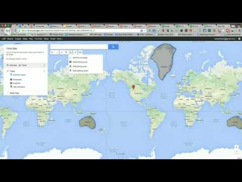
Through Google My Maps students can explore the basics of cartography, share information about local communities and far-flung destinations. The map is their canvas on which they can build with points, lines and polygons, and they can go as far as their imagination leads them.
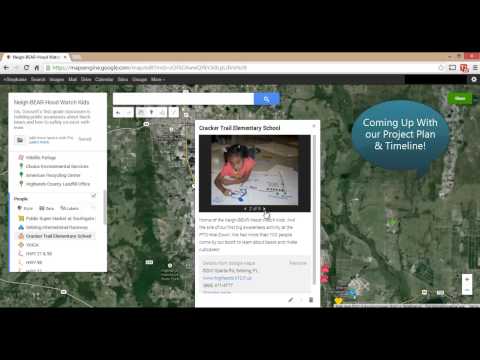
Neigh-BEAR-Hood Watch Kids
While Orlando's most famous animal resident might be a certain mouse and his magical kingdom, Ms. Gossett's first grade classroom is building maps for public awareness about another neighborhood visitor; black bears and how to safely co-exist with them.
Quick Tip
You can view My Maps in Google Earth by first exporting to a Keyhole Markup Language (KML) format file, which can then be opened in Google Earth's "My Places".
Maps for Mathematics
Did you know you can use My Maps to do Mathematics? Use the ruler tool to calculate distances in various units of measurement. On his blog the “The Curious Creative”, Tom Barrett shows how to use My Maps as an interface for crowd-sourcing activities around measuring, arithmetic, basic statistics, geometry and more.

How Big is...
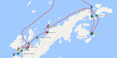
Ever tried to describe to your students the size or scale of something they have never seen? Canadian teacher, and Grosvenor Teacher Fellow (2015), Ellie Clin used My Maps to explain just how big the B15 iceberg, which she passed by onboard the National Geographic Explorer expedition ship, truly is.
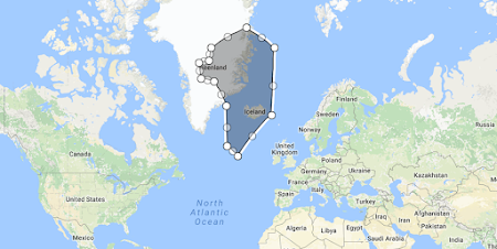
Everybody Lies (even Maps)
Ever wondered why Greenland is so huge? Clearly much larger than Brazil, looking at the map on the wall. Or is it…? Let Josh Williams, a geography teacher from Austin, Texas, explain why all might not be as it seems.
“I haven't been everywhere but it's on my list” - Susan Sontag